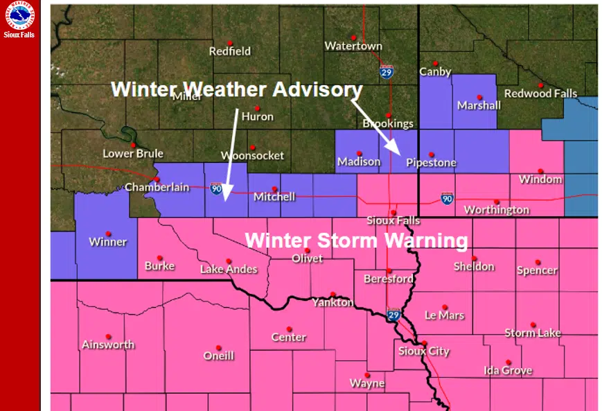
Advisories issued for the region ahead of Wednesday's snowstorm. Image Courtesy of NWS Sioux Falls.
SIOUX FALLS, S.D. (KELO.com) — As another round of winter precipitation enters the region Wednesday, advisories have been issued for a majority of the KELO listening area.
A Winter Weather Advisory has been issued for areas west and north of Sioux Falls.
The National Weather Service has since upgraded the Sioux Falls metro, along with areas to our south and east, to a Winter Storm Warning.
Snow is expected to develop near south central South Dakota and Nebraska late Wednesday morning before tracking northeast throughout the day.
Most of the area will remain dry through 3 p.m.
Here is a look at the initial onset of snow tomorrow.
— NWS Sioux Falls (@NWSSiouxFalls) January 18, 2023
Snow is expected to overspread the area from south to north throughout the day tomorrow.
This storm will begin with high snow rates off the bat, quickly reducing visibilities and covering roads.
Stay weather aware! pic.twitter.com/3lDAsc3t9F
This particular storm will have the greatest impacts near the Missouri River with snowfall totals ranging anywhere from 7-12 inches.
Depending on the path of the storm, Sioux Falls could see up to 7 inches.
Several hazards are expected with the arrival of this system.
Heavy snowfall rates of 1-3 inches per hour may occur, which can rapidly change visibilities and road conditions.
Wind gusts of up to 30 mph are also expected with this storm, which may produce blowing snow across roadways.
If you plan on traveling over the next couple of days, make sure to monitor your local forecast, take a look at road conditions at SD511.org, and check back in with KELO radio for more updates throughout the day.


Comments