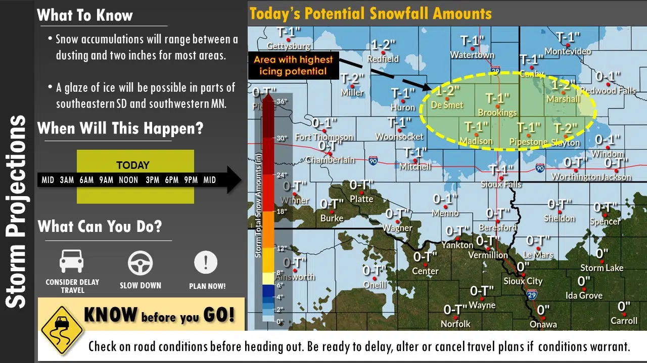
Image courtesy of the National Weather Service in Sioux Falls
SIOUX FALLS, S.D. (KELO.com) — As another round of precipitation moves across the northern plains, regional travel impacts are already being felt.
While rain, and eventually snow, is occurring throughout the KELO listening area, conditions to our west are quickly deteriorating.
SD511.org shows that Interstate 90 between Chamberlain and Mitchell is slippery with scattered spots of ice and snow.
With a myriad of precipitation types falling across the region, lets take a look at some of the webcams to see what is happening.
— NWS Sioux Falls (@NWSSiouxFalls) January 16, 2023
First image comes from Kimball, SD on I-90 showing light snowfall & partially snow covered roads with decent visibility.
📸: @SouthDakotaDOT pic.twitter.com/aNEPOlDnFR
As rain switches over to snow this afternoon, the National Weather Service says that a glaze of ice could impact southwest Minnesota and southeast South Dakota.
While snowfall totals should remain light, the combination of snow and ice will create slippery walkways and roadways during the evening commute.
Below is a graphic detailing the timing of when rain is likely to transition to sleet and snow.
Here’s a look at the latest precipitation type and timing across the area today, tonight, and early Tuesday morning.
— NWS Sioux Falls (@NWSSiouxFalls) January 16, 2023
If you will be driving across the area, especially north of I-90, please monitor road conditions at https://t.co/FTb7bxiMpt . pic.twitter.com/r9lBTRJh6M
Make sure you monitor both the forecast and road conditions before heading out the door today.


Comments