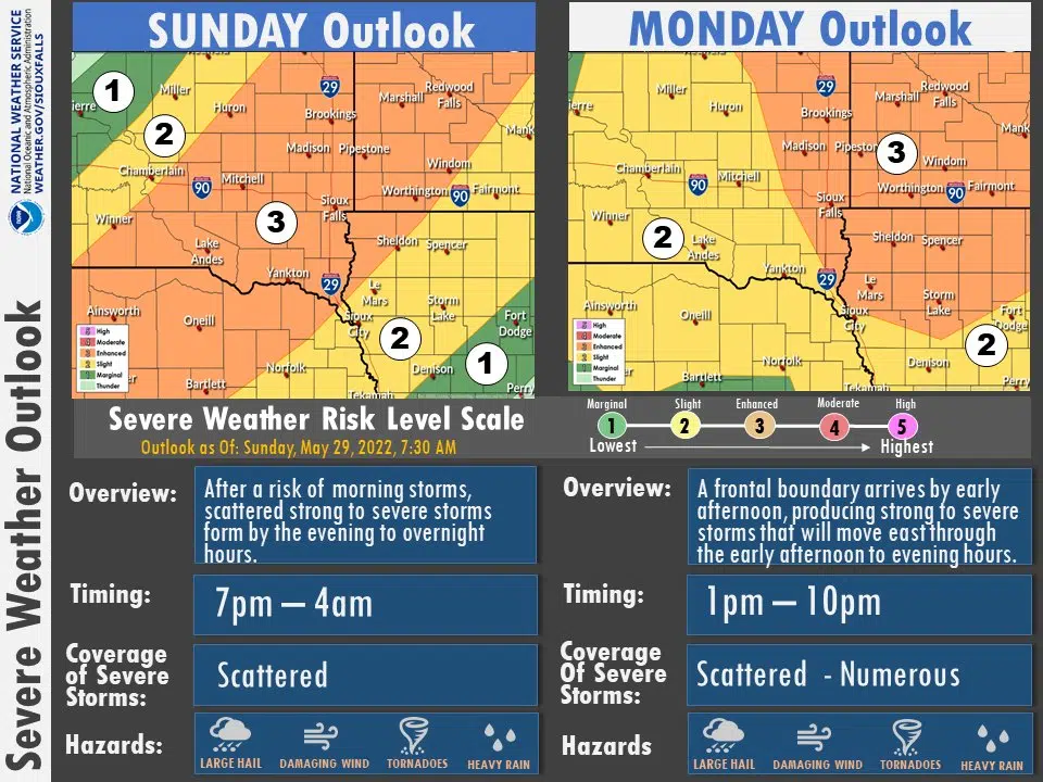
SIOUX FALLS, S.D. (KELO.com) — Round two of severe weather is expected later tonight and into the overnight hours. The Sioux Falls National Weather Service says the parts of southeast South Dakota, southwest Minnesota, and northwest Iowa are in an enhanced (level 3 out of 5) risk for severe weather. Large hail, strong winds, and a tornado or two are possible with these severe storms. Storms could approach the Sioux Falls area by eight o’clock tonight. The third round of severe weather could develop as early as midday on Memorial Day in central South Dakota. With plenty of camping and other outdoor activities, the weather service is advising keeping a close eye on the weather. Check often for forecast changes through the holiday weekend. The Sioux Falls National Weather Service addressed the severe weather threat earlier on Facebook. Watch at the following link:
https://www.facebook.com/NWSSiouxFalls/videos/693956861833833


