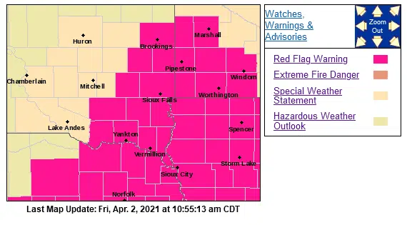
NWS watches and warnings map, 4/2/21.
SIOUX FALLS, S.D. (KELO.com) — The Sioux Falls metro area and most of the KELO Radio listening area is in a Red Flag Warning until 8 p.m. Friday.
See the map at the right and click here for more information.
The Sioux Falls National Weather Service advises:
* AFFECTED AREA…Southwest Minnesota, northwest Iowa, northeast Nebraska and far eastern South Dakota.
* WIND…South 20 to 30 mph with gusts of 40 to 45 mph.
* HUMIDITY…lowest humidity 20 to 25 percent.
* IMPACTS…Any fires that develop will likely spread rapidly. Outdoor burning is not recommended.
PRECAUTIONARY/PREPAREDNESS ACTIONS… A Red Flag Warning means that critical fire weather conditions are either occurring now….or will shortly. A combination of strong winds…low relative humidity…and warm temperatures can contribute to extreme fire behavior.
Areas not under a Red Flag Warning are under a Special Weather Statement:
Gusty southerly winds and a dry air mass will lead to very high fire danger today. The strongest winds gusting to 25 to 35 mph, possibly higher in southwest Minnesota, are expected this morning. Wind speeds are expected to slowly weaken through the afternoon, as humidity levels fall to around 25 percent.
People are urged to exercise extreme care with respect to outdoor activities that could cause grass fires. Avoid equipment that can cause sparks near dry grass or brush. Do not toss cigarettes on the ground. Report new fires quickly to the nearest fire department or law enforcement office.