SIOUX FALLS, S.D. (KELO.com) — The National Weather Service in Sioux Falls’ forecast:
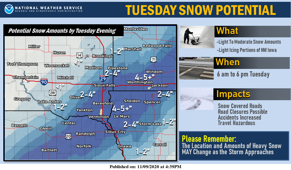
A light wintry mix overnight will change to all snow on Tuesday.
Moderate snow amounts will be possible.
The Highest amounts will occur from far southeastern SD, into northwestern IA and southwestern MN where 4 to 5″ will be possible.
Locally higher amounts will be possible. Precipitation is expected to end by Tuesday evening.
———————————
Lincoln-Lyon-Murray-Pipestone-Rock-Brookings-Lake-Moody-McCook-
Minnehaha-
...WINTER WEATHER ADVISORY REMAINS IN EFFECT FROM 9 AM THIS MORNING TO 9 PM CST THIS EVENING...
* WHAT...Snow expected. Total snow accumulations of 2 to 6 inches.
* WHERE...Portions of east central and southeast South Dakota and southwest Minnesota.
* WHEN...From 9 AM this morning to 9 PM CST this evening.
* IMPACTS...Plan on slippery road conditions. The hazardous conditions could impact the evening commute.

Tune into KELO Radio for the latest on our wintry weather.